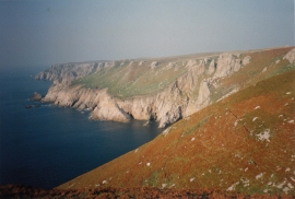
Devil's Chimney, Devon

« Gazetteer Entry
Upload Photo

Devil's Chimney, Devon

  • Parish/Community: Area not comprised in any Parish-Lundy Island
  • District/Borough: Torridge
  • County: Devon
  • Region: South West
  • Category: Geographic Feature
  • Type: Other Coastal Landform
  • Latitude/Longitude: 51°10'45"N 4°40'28"W
  • Eastings/Northings: 213164, 145623
  • OS Grid: SS131456
  • Mapcode Local: GBR GTTK.ZGH
  • Mapcode Global: VH2S3.XMND

Location and coordinates are for the approximate centre of Devil's Chimney within this administrative area. Geographic features and populated places may cross administrative borders.

BritishPlaceNames.uk is a Good Stuff website.