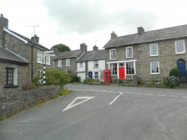
Derwen Gam, Ceredigion

(Oakford)

« Gazetteer Entry
Upload Photo

Derwen Gam, Ceredigion

Other current and historical names

  • Oakford
  • Parish/Community: Henfynyw
  • Unitary Authority: Ceredigion
  • Region: Wales
  • Category: Populated Place
  • Type: Village
  • Latitude/Longitude: 52°11'55"N 4°15'58"W
  • Eastings/Northings: 245204, 258027
  • OS Grid: SN452580
  • Mapcode Local: GBR DJ.3LD9
  • Mapcode Global: VH3JS.0ZDW

Location and coordinates are for the approximate centre of Derwen Gam within this administrative area. Geographic features and populated places may cross administrative borders.

BritishPlaceNames.uk is a Good Stuff website.