-
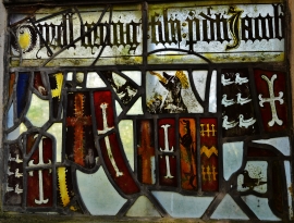
Gipping: The chapel of St. Nicholas: Fragments of medieval glass in the east window 5
-
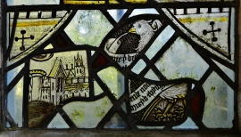
Gipping: The chapel of St. Nicholas: Fragments of medieval glass in the east window 4
Gipping: The chapel of St. Nicholas: Fragments of medieval glass in the east window 5
Gipping: The chapel of St. Nicholas: Fragments of medieval glass in the east window 4
Location and coordinates are for the approximate centre of Deal Plantn within this administrative area. Geographic features and populated places may cross administrative borders.