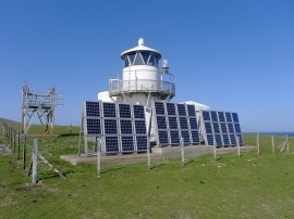
Da Rippack Stack, Shetland Islands

« Gazetteer Entry
Upload Photo

Da Rippack Stack, Shetland Islands

  • Unitary Authority: Shetland Islands
  • Region: Scotland
  • Category: Water Feature
  • Type: Island
  • Latitude/Longitude: 60°6'42"N 2°3'33"W
  • Eastings/Northings: 396797, 1136360
  • OS Grid: HT967363
  • Mapcode Local: GBR P280.H5R
  • Mapcode Global: XHBWG.J3VD

Location and coordinates are for the approximate centre of Da Rippack Stack within this administrative area. Geographic features and populated places may cross administrative borders.

BritishPlaceNames.uk is a Good Stuff website.