-

View at Cold Kitchen Triangulation Pillar
-
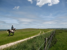
Horseriders on the track to the Trig Point
View at Cold Kitchen Triangulation Pillar
Horseriders on the track to the Trig Point
Location and coordinates are for the approximate centre of Cold Kitchen Hill within this administrative area. Geographic features and populated places may cross administrative borders.