-
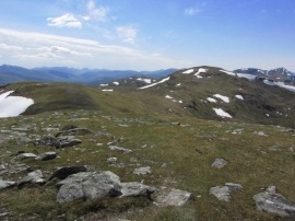
On the summit of Beinn Beinn Cheathaich with ridge leading towards Meall Glas
-

Trig point on the summit of Beinn Cheathaich
On the summit of Beinn Beinn Cheathaich with ridge leading towards Meall Glas
Trig point on the summit of Beinn Cheathaich
Location and coordinates are for the approximate centre of Coire Na Saobhaidhe within this administrative area. Geographic features and populated places may cross administrative borders.