-

Lane near Coed-y-mwstwr Golf Club
-
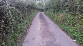
Lane at Tyn-y-Caeau
Lane near Coed-y-mwstwr Golf Club
Lane at Tyn-y-Caeau
Location and coordinates are for the approximate centre of Coedbrynglas within this administrative area. Geographic features and populated places may cross administrative borders.