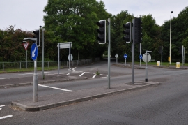
Coed-y-rutla, Bridgend

« Gazetteer Entry
Upload Photo

Coed-y-rutla, Bridgend

  • Parish/Community: Bridgend
  • Unitary Authority: Bridgend
  • Region: Wales
  • Category: Landcover
  • Type: Forest or Wood
  • Latitude/Longitude: 51°31'13"N 3°35'28"W
  • Eastings/Northings: 289691, 181366
  • OS Grid: SS896813
  • Mapcode Local: GBR HC.HKC8
  • Mapcode Global: VH5HJ.P1SS

Location and coordinates are for the approximate centre of Coed-y-rutla within this administrative area. Geographic features and populated places may cross administrative borders.

BritishPlaceNames.uk is a Good Stuff website.