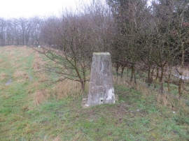
Cid Wood, Northamptonshire

« Gazetteer Entry
Upload Photo

Cid Wood, Northamptonshire

  • Parish/Community: Weekley
  • District/Borough: Kettering
  • County: Northamptonshire
  • Region: East Midlands
  • Category: Landcover
  • Type: Forest or Wood
  • Latitude/Longitude: 52°25'35"N 0°42'50"W
  • Eastings/Northings: 487531, 281725
  • OS Grid: SP875817
  • Mapcode Local: GBR CVJ.SBR
  • Mapcode Global: VHDR9.K8TP

Location and coordinates are for the approximate centre of Cid Wood within this administrative area. Geographic features and populated places may cross administrative borders.

BritishPlaceNames.uk is a Good Stuff website.