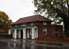
Catterick Garrison, North Yorkshire

« Gazetteer Entry
Upload Photo

Catterick Garrison, North Yorkshire

  • Built-Up Area: Catterick Garrison
  • Parish/Community: Hipswell
  • District/Borough: Richmondshire
  • County: North Yorkshire
  • Region: Yorkshire and The Humber
  • Category: Populated Place
  • Type: Other Settlement
  • Latitude/Longitude: 54°22'33"N 1°43'19"W
  • Eastings/Northings: 418151, 497873
  • OS Grid: SE181978
  • Mapcode Local: GBR JKDV.Z2
  • Mapcode Global: WHC6L.J85L

Location and coordinates are for the approximate centre of Catterick Garrison within this administrative area. Geographic features and populated places may cross administrative borders.

BritishPlaceNames.uk is a Good Stuff website.