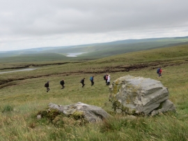
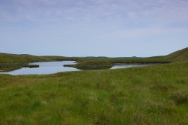
Carreg naw llyn, Ceredigion

« Gazetteer Entry
Upload Photo

Carreg naw llyn, Ceredigion

  • Parish/Community: Ystrad Fflur
  • Unitary Authority: Ceredigion
  • Region: Wales
  • Category: Geographic Feature
  • Type: Hill or Mountain
  • Latitude/Longitude: 52°18'50"N 3°45'56"W
  • Eastings/Northings: 279740, 269912
  • OS Grid: SN797699
  • Mapcode Local: GBR 95.WCJ4
  • Mapcode Global: VH5CK.P34B

Location and coordinates are for the approximate centre of Carreg naw llyn within this administrative area. Geographic features and populated places may cross administrative borders.

BritishPlaceNames.uk is a Good Stuff website.