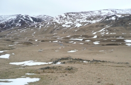
Carn Aig Mhala, Angus

« Gazetteer Entry
Upload Photo

Carn Aig Mhala, Angus

  • Unitary Authority: Angus
  • Region: Scotland
  • Category: Geographic Feature
  • Type: Hill or Mountain
  • Latitude/Longitude: 56°50'12"N 3°24'42"W
  • Eastings/Northings: 313967, 772575
  • OS Grid: NO139725
  • Mapcode Local: GBR W0.R7MH
  • Mapcode Global: WH6N7.KFL8

Location and coordinates are for the approximate centre of Carn Aig Mhala within this administrative area. Geographic features and populated places may cross administrative borders.

BritishPlaceNames.uk is a Good Stuff website.