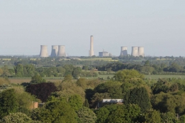
Carmel Meadows, Oxfordshire

« Gazetteer Entry
Upload Photo

Carmel Meadows, Oxfordshire

  • Parish/Community: Crowmarsh
  • District/Borough: South Oxfordshire
  • County: Oxfordshire
  • Region: South East
  • Category: Landcover
  • Type: Other Landcover
  • Latitude/Longitude: 51°35'4"N 1°7'4"W
  • Eastings/Northings: 461209, 187669
  • OS Grid: SU612876
  • Mapcode Local: GBR B2L.L5L
  • Mapcode Global: VHCYP.KFTL

Location and coordinates are for the approximate centre of Carmel Meadows within this administrative area. Geographic features and populated places may cross administrative borders.

BritishPlaceNames.uk is a Good Stuff website.