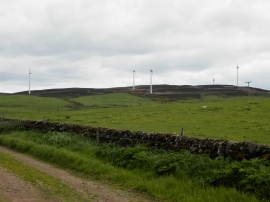
Carlunie Hill, Angus

« Gazetteer Entry
Upload Photo

Carlunie Hill, Angus

  • Unitary Authority: Angus
  • Region: Scotland
  • Category: Geographic Feature
  • Type: Hill or Mountain
  • Latitude/Longitude: 56°34'37"N 3°2'2"W
  • Eastings/Northings: 336568, 743259
  • OS Grid: NO365432
  • Mapcode Local: GBR VJ.6M4R
  • Mapcode Global: WH7QQ.CYFC

Location and coordinates are for the approximate centre of Carlunie Hill within this administrative area. Geographic features and populated places may cross administrative borders.

BritishPlaceNames.uk is a Good Stuff website.