-
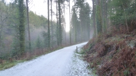
Iced track, Canakey Wood, Deerpark, Cornwall
-

Cabins in Deerpark, near Herodsfoot
Iced track, Canakey Wood, Deerpark, Cornwall
Cabins in Deerpark, near Herodsfoot
Location and coordinates are for the approximate centre of Canakey Wood within this administrative area. Geographic features and populated places may cross administrative borders.