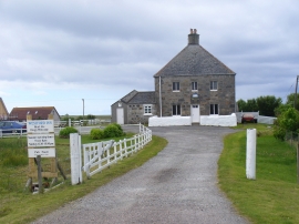
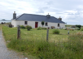
Camas Mhic an Trilleachain, Na h-Eileanan Siar

« Gazetteer Entry
Upload Photo

Camas Mhic an Trilleachain, Na h-Eileanan Siar

  • Unitary Authority: Na h-Eileanan Siar
  • Region: Scotland
  • Category: Water Feature
  • Type: Bay
  • Latitude/Longitude: 57°33'58"N 7°23'38"W
  • Eastings/Northings: 77617, 865742
  • OS Grid: NF776657
  • Mapcode Local: GBR 884Q.N39
  • Mapcode Global: WGV2C.D29X

Location and coordinates are for the approximate centre of Camas Mhic an Trilleachain within this administrative area. Geographic features and populated places may cross administrative borders.

BritishPlaceNames.uk is a Good Stuff website.