-

The Old School, Great Coxwell
-
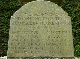
Names on Great Coxwell war memorial
The Old School, Great Coxwell
Names on Great Coxwell war memorial
Location and coordinates are for the approximate centre of Buryhill Copse within this administrative area. Geographic features and populated places may cross administrative borders.