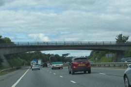
Bromley Heath, South Gloucestershire

« Gazetteer Entry
Upload Photo

Bromley Heath, South Gloucestershire

Other current and historical names

  • Moorend
  • Built-Up Area: Bristol
  • Parish/Community: Downend and Bromley Heath
  • Unitary Authority: South Gloucestershire
  • Region: South West
  • Category: Populated Place
  • Type: Other Settlement
  • Latitude/Longitude: 51°30'15"N 2°29'54"W
  • Eastings/Northings: 365500, 178500
  • OS Grid: ST655785
  • Mapcode Local: GBR JV.JJ81
  • Mapcode Global: VH88H.NG13

Location and coordinates are for the approximate centre of Bromley Heath within this administrative area. Geographic features and populated places may cross administrative borders.

BritishPlaceNames.uk is a Good Stuff website.