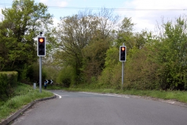
Brick Kiln Copse, Basingstoke and Deane

« Gazetteer Entry
Upload Photo

Brick Kiln Copse, Basingstoke and Deane

  • Parish/Community: Sulhamstead
  • Unitary Authority: Basingstoke and Deane
  • Region: South East
  • Category: Landcover
  • Type: Forest or Wood
  • Latitude/Longitude: 51°25'10"N 1°4'3"W
  • Eastings/Northings: 464932, 169360
  • OS Grid: SU649693
  • Mapcode Local: GBR B4L.T28
  • Mapcode Global: VHCZH.FLY5

Location and coordinates are for the approximate centre of Brick Kiln Copse within this administrative area. Geographic features and populated places may cross administrative borders.

BritishPlaceNames.uk is a Good Stuff website.