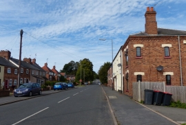
Bret's Hall Wood, Warwickshire

« Gazetteer Entry
Upload Photo

Bret's Hall Wood, Warwickshire

  • Parish/Community: Ansley
  • District/Borough: North Warwickshire
  • County: Warwickshire
  • Region: West Midlands
  • Category: Landcover
  • Type: Forest or Wood
  • Latitude/Longitude: 52°32'7"N 1°32'28"W
  • Eastings/Northings: 431215, 293170
  • OS Grid: SP312931
  • Mapcode Local: GBR 6KM.14H
  • Mapcode Global: VHBWC.7JKN

Location and coordinates are for the approximate centre of Bret's Hall Wood within this administrative area. Geographic features and populated places may cross administrative borders.

BritishPlaceNames.uk is a Good Stuff website.