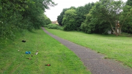
Bourn Brook, Birmingham

« Gazetteer Entry
Upload Photo

Bourn Brook, Birmingham

  • Built-Up Area: Birmingham
  • Parish/Community: Birmingham, unparished area
  • Unitary Authority: Birmingham
  • Region: West Midlands
  • Category: Water Feature
  • Type: Other Water Feature
  • Latitude/Longitude: 52°26'58"N 1°58'45"W
  • Eastings/Northings: 401500, 283500
  • OS Grid: SP015835
  • Mapcode Local: GBR 5FM.TT
  • Mapcode Global: VH9Z1.MPYM

Location and coordinates are for the approximate centre of Bourn Brook within this administrative area. Geographic features and populated places may cross administrative borders.

BritishPlaceNames.uk is a Good Stuff website.