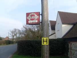
Bottom Wood, Buckinghamshire

« Gazetteer Entry
Upload Photo

Bottom Wood, Buckinghamshire

  • Parish/Community: Chartridge
  • District/Borough: Chiltern
  • County: Buckinghamshire
  • Region: South East
  • Category: Landcover
  • Type: Forest or Wood
  • Latitude/Longitude: 51°43'45"N 0°40'12"W
  • Eastings/Northings: 491941, 204231
  • OS Grid: SP919042
  • Mapcode Local: GBR F5D.KCT
  • Mapcode Global: VHFS2.BSKP

Location and coordinates are for the approximate centre of Bottom Wood within this administrative area. Geographic features and populated places may cross administrative borders.

BritishPlaceNames.uk is a Good Stuff website.