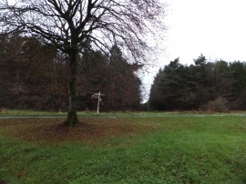
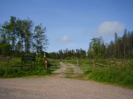
Blannicombe Plantation, Devon

« Gazetteer Entry
Upload Photo

Blannicombe Plantation, Devon

  • Parish/Community: Honiton
  • District/Borough: East Devon
  • County: Devon
  • Region: South West
  • Category: Landcover
  • Type: Forest or Wood
  • Latitude/Longitude: 50°45'57"N 3°11'49"W
  • Eastings/Northings: 315668, 96948
  • OS Grid: SY156969
  • Mapcode Local: GBR P9.X08C
  • Mapcode Global: FRA 4762.0UG

Location and coordinates are for the approximate centre of Blannicombe Plantation within this administrative area. Geographic features and populated places may cross administrative borders.

BritishPlaceNames.uk is a Good Stuff website.