-
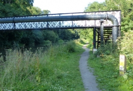
Bestway Footbridge No 201 and pipe bridge
-

Trent and Mersey Canal south-west of Anderton, Cheshire
Bestway Footbridge No 201 and pipe bridge
Trent and Mersey Canal south-west of Anderton, Cheshire
Location and coordinates are for the approximate centre of Bestway Wood within this administrative area. Geographic features and populated places may cross administrative borders.