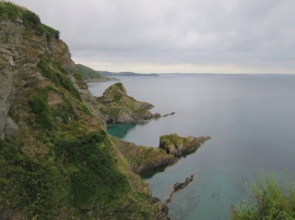
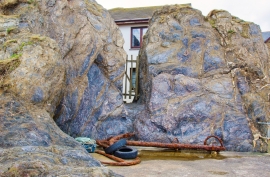
Benny Island, Cornwall

« Gazetteer Entry
Upload Photo

Benny Island, Cornwall

  • Built-Up Area: Mevagissey
  • Parish/Community: Mevagissey
  • Unitary Authority: Cornwall
  • Region: South West
  • Category: Water Feature
  • Type: Island
  • Latitude/Longitude: 50°16'14"N 4°46'59"W
  • Eastings/Northings: 201770, 44908
  • OS Grid: SX017449
  • Mapcode Local: GBR ZY.S0XT
  • Mapcode Global: FRA 08W9.SH0

Location and coordinates are for the approximate centre of Benny Island within this administrative area. Geographic features and populated places may cross administrative borders.

BritishPlaceNames.uk is a Good Stuff website.