-
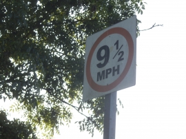
Unusual speed limit for Hadley's, Trash Green
-
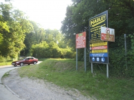
The entrance to Hadley Waste Disposal, Trash Green
Unusual speed limit for Hadley's, Trash Green
The entrance to Hadley Waste Disposal, Trash Green
Location and coordinates are for the approximate centre of Bennettshill Copse within this administrative area. Geographic features and populated places may cross administrative borders.