-

The bealach between Beinn nan Eachan and Creag na Caillich
-
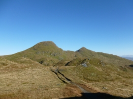
Bealach between Creag na Caillich and Beinn nan Eachan
The bealach between Beinn nan Eachan and Creag na Caillich
Bealach between Creag na Caillich and Beinn nan Eachan
Location and coordinates are for the approximate centre of Beinn a' Bhuic within this administrative area. Geographic features and populated places may cross administrative borders.