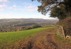
Bearacleave Wood, Devon

« Gazetteer Entry
Upload Photo

Bearacleave Wood, Devon

  • Parish/Community: Bovey Tracey
  • District/Borough: Teignbridge
  • County: Devon
  • Region: South West
  • Category: Landcover
  • Type: Forest or Wood
  • Latitude/Longitude: 50°36'15"N 3°40'35"W
  • Eastings/Northings: 281466, 79620
  • OS Grid: SX814796
  • Mapcode Local: GBR QM.G967
  • Mapcode Global: FRA 375G.RKG

Location and coordinates are for the approximate centre of Bearacleave Wood within this administrative area. Geographic features and populated places may cross administrative borders.

BritishPlaceNames.uk is a Good Stuff website.