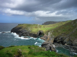
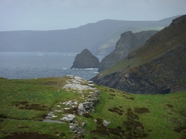
Barras Gug, Cornwall

« Gazetteer Entry
Upload Photo

Barras Gug, Cornwall

  • Built-Up Area: Tintagel
  • Parish/Community: Tintagel
  • Unitary Authority: Cornwall
  • Region: South West
  • Category: Water Feature
  • Type: Bay
  • Latitude/Longitude: 50°40'15"N 4°45'11"W
  • Eastings/Northings: 205554, 89328
  • OS Grid: SX055893
  • Mapcode Local: GBR N1.72WR
  • Mapcode Global: FRA 07Y9.D2X

Location and coordinates are for the approximate centre of Barras Gug within this administrative area. Geographic features and populated places may cross administrative borders.

BritishPlaceNames.uk is a Good Stuff website.