-

Railway Junction at Barnt Green
-
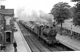
Barnt Green Station, with an Up freight
Railway Junction at Barnt Green
Barnt Green Station, with an Up freight
Location and coordinates are for the approximate centre of Barnt Green within this administrative area. Geographic features and populated places may cross administrative borders.