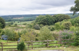
Alderbed Plantation, Devon

« Gazetteer Entry
Upload Photo

Alderbed Plantation, Devon

  • Parish/Community: Petrockstow
  • District/Borough: Torridge
  • County: Devon
  • Region: South West
  • Category: Landcover
  • Type: Forest or Wood
  • Latitude/Longitude: 50°51'46"N 4°6'27"W
  • Eastings/Northings: 251768, 109146
  • OS Grid: SS517091
  • Mapcode Local: GBR KN.TZ3M
  • Mapcode Global: FRA 268T.KHT

Location and coordinates are for the approximate centre of Alderbed Plantation within this administrative area. Geographic features and populated places may cross administrative borders.

BritishPlaceNames.uk is a Good Stuff website.