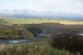
Woodside Meadows, Renfrewshire

« Gazetteer Entry
Upload Photo

Woodside Meadows, Renfrewshire

  • Unitary Authority: Renfrewshire
  • Region: Scotland
  • Category: Landcover
  • Type: Other Landcover
  • Latitude/Longitude: 55°46'11"N 4°38'32"W
  • Eastings/Northings: 234338, 656111
  • OS Grid: NS343561
  • Mapcode Local: GBR 39.9FQN
  • Mapcode Global: WH2NB.N7JK

Location and coordinates are for the approximate centre of Woodside Meadows within this administrative area. Geographic features and populated places may cross administrative borders.

BritishPlaceNames.uk is a Good Stuff website.