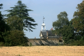
Wilderness, Havering

« Gazetteer Entry
Upload Photo

Wilderness, Havering

  • Parish/Community: Havering, unparished area
  • Unitary Authority: Havering
  • Region: London
  • Category: Landcover
  • Type: Forest or Wood
  • Latitude/Longitude: 51°37'19"N 0°11'50"E
  • Eastings/Northings: 552219, 193769
  • OS Grid: TQ522937
  • Mapcode Local: GBR T9.DGK
  • Mapcode Global: VHHN1.CHR8

Location and coordinates are for the approximate centre of Wilderness within this administrative area. Geographic features and populated places may cross administrative borders.

BritishPlaceNames.uk is a Good Stuff website.