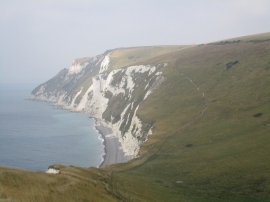
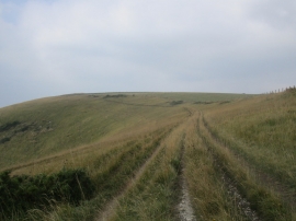
West Bottom, Dorset

« Gazetteer Entry
Upload Photo

West Bottom, Dorset

  • Parish/Community: Owermoigne
  • District/Borough: Purbeck
  • County: Dorset
  • Region: South West
  • Category: Geographic Feature
  • Type: Valley
  • Latitude/Longitude: 50°37'36"N 2°18'40"W
  • Eastings/Northings: 378075, 80823
  • OS Grid: SY780808
  • Mapcode Local: GBR 10N.QFD
  • Mapcode Global: FRA 671D.WYM

Location and coordinates are for the approximate centre of West Bottom within this administrative area. Geographic features and populated places may cross administrative borders.

BritishPlaceNames.uk is a Good Stuff website.