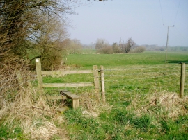
Wadbrook Coppice, Devon

« Gazetteer Entry
Upload Photo

Wadbrook Coppice, Devon

  • Parish/Community: Hawkchurch
  • District/Borough: East Devon
  • County: Devon
  • Region: South West
  • Category: Landcover
  • Type: Forest or Wood
  • Latitude/Longitude: 50°48'18"N 2°57'39"W
  • Eastings/Northings: 332375, 101064
  • OS Grid: ST323010
  • Mapcode Local: GBR M7.YMMT
  • Mapcode Global: FRA 46PY.VM8

Location and coordinates are for the approximate centre of Wadbrook Coppice within this administrative area. Geographic features and populated places may cross administrative borders.

BritishPlaceNames.uk is a Good Stuff website.