-

Down train of new carriages at site of Madeley Station
-
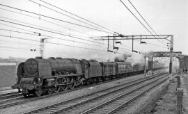
Euston - Perth express at Madeley
Down train of new carriages at site of Madeley Station
Euston - Perth express at Madeley
Location and coordinates are for the approximate centre of Upper Bitterns Wood within this administrative area. Geographic features and populated places may cross administrative borders.