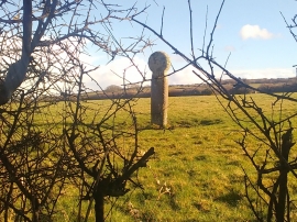
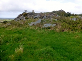
Trevales Wood, Cornwall

« Gazetteer Entry
Upload Photo

Trevales Wood, Cornwall

  • Parish/Community: Stithians
  • Unitary Authority: Cornwall
  • Region: South West
  • Category: Landcover
  • Type: Forest or Wood
  • Latitude/Longitude: 50°10'41"N 5°9'32"W
  • Eastings/Northings: 174557, 35686
  • OS Grid: SW745356
  • Mapcode Local: GBR Z7.GXN0
  • Mapcode Global: FRA 082K.3ZP

Location and coordinates are for the approximate centre of Trevales Wood within this administrative area. Geographic features and populated places may cross administrative borders.

BritishPlaceNames.uk is a Good Stuff website.