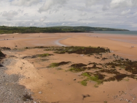
Traeth Lligwy, Isle of Anglesey

« Gazetteer Entry
Upload Photo

Traeth Lligwy, Isle of Anglesey

  • Parish/Community: Moelfre
  • Unitary Authority: Isle of Anglesey
  • Region: Wales
  • Category: Geographic Feature
  • Type: Beach
  • Latitude/Longitude: 53°21'43"N 4°15'35"W
  • Eastings/Northings: 249721, 387401
  • OS Grid: SH497874
  • Mapcode Local: GBR HMVT.9H3
  • Mapcode Global: WH428.JRRD

Location and coordinates are for the approximate centre of Traeth Lligwy within this administrative area. Geographic features and populated places may cross administrative borders.

BritishPlaceNames.uk is a Good Stuff website.