-
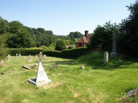
Part of the graveyard of St Peter ad Vincula church, Tollard Royal
-

Rushmore Park, bluebells
Part of the graveyard of St Peter ad Vincula church, Tollard Royal
Rushmore Park, bluebells
Location and coordinates are for the approximate centre of Tollard Plantation within this administrative area. Geographic features and populated places may cross administrative borders.