-
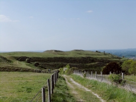
The hill fort at Hambledon Hill: the approach from the south
-

Hambledon Hill
The hill fort at Hambledon Hill: the approach from the south
Hambledon Hill
Location and coordinates are for the approximate centre of Terrace Coppice within this administrative area. Geographic features and populated places may cross administrative borders.