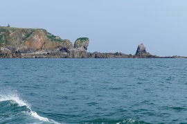
Star Cliff, Pembrokeshire

« Gazetteer Entry
Upload Photo

Star Cliff, Pembrokeshire

  • Parish/Community: Tenby
  • Unitary Authority: Pembrokeshire
  • Region: Wales
  • Category: Geographic Feature
  • Type: Cliff or Slope
  • Latitude/Longitude: 51°38'27"N 4°42'28"W
  • Eastings/Northings: 212722, 197043
  • OS Grid: SS127970
  • Mapcode Local: GBR GF.9N4H
  • Mapcode Global: VH2PZ.B0YX

Location and coordinates are for the approximate centre of Star Cliff within this administrative area. Geographic features and populated places may cross administrative borders.

BritishPlaceNames.uk is a Good Stuff website.