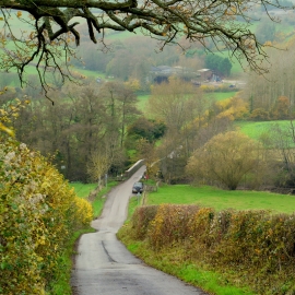
St Maughans Green, Monmouthshire

« Gazetteer Entry
Upload Photo

St Maughans Green, Monmouthshire

  • Parish/Community: Llangattock-Vibon-Avel
  • Unitary Authority: Monmouthshire
  • Region: Wales
  • Category: Populated Place
  • Type: Other Settlement
  • Latitude/Longitude: 51°51'13"N 2°45'49"W
  • Eastings/Northings: 347500, 217500
  • OS Grid: SO475175
  • Mapcode Local: GBR FJ.TF3D
  • Mapcode Global: VH86M.1NTW

Location and coordinates are for the approximate centre of St Maughans Green within this administrative area. Geographic features and populated places may cross administrative borders.

BritishPlaceNames.uk is a Good Stuff website.