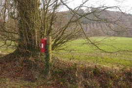
Springfield Coppice, Shropshire

« Gazetteer Entry
Upload Photo

Springfield Coppice, Shropshire

  • Parish/Community: Munslow
  • Unitary Authority: Shropshire
  • Region: West Midlands
  • Category: Landcover
  • Type: Forest or Wood
  • Latitude/Longitude: 52°30'46"N 2°42'20"W
  • Eastings/Northings: 352215, 290798
  • OS Grid: SO522907
  • Mapcode Local: GBR BL.GW19
  • Mapcode Global: VH83K.231C

Location and coordinates are for the approximate centre of Springfield Coppice within this administrative area. Geographic features and populated places may cross administrative borders.

BritishPlaceNames.uk is a Good Stuff website.