-

Footbridge in Sailors Grove
-
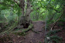
Oak tree in Sailors Grove
Footbridge in Sailors Grove
Oak tree in Sailors Grove
Location and coordinates are for the approximate centre of Sailor's Grove within this administrative area. Geographic features and populated places may cross administrative borders.