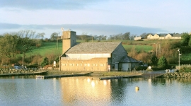
Rogerton, South Lanarkshire

« Gazetteer Entry
Upload Photo

Rogerton, South Lanarkshire

  • Unitary Authority: South Lanarkshire
  • Region: Scotland
  • Category: Populated Place
  • Type: Hamlet
  • Latitude/Longitude: 55°47'4"N 4°11'15"W
  • Eastings/Northings: 262907, 656747
  • OS Grid: NS629567
  • Mapcode Local: GBR 3V.8P4G
  • Mapcode Global: WH4QM.NV1X

Location and coordinates are for the approximate centre of Rogerton within this administrative area. Geographic features and populated places may cross administrative borders.

BritishPlaceNames.uk is a Good Stuff website.