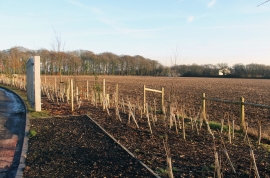
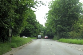
Reading Shaw, Buckinghamshire

« Gazetteer Entry
Upload Photo

Reading Shaw, Buckinghamshire

  • Built-Up Area: Clayhill
  • Parish/Community: Great Marlow
  • District/Borough: Wycombe
  • County: Buckinghamshire
  • Region: South East
  • Category: Landcover
  • Type: Forest or Wood
  • Latitude/Longitude: 51°36'22"N 0°47'45"W
  • Eastings/Northings: 483475, 190406
  • OS Grid: SU834904
  • Mapcode Local: GBR D5G.9JQ
  • Mapcode Global: VHDW4.5W0H

Location and coordinates are for the approximate centre of Reading Shaw within this administrative area. Geographic features and populated places may cross administrative borders.

BritishPlaceNames.uk is a Good Stuff website.