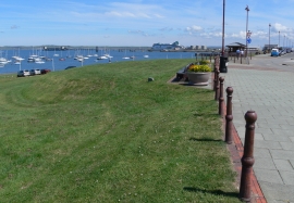
Porth-y-felin, Isle of Anglesey

« Gazetteer Entry
Upload Photo

Porth-y-felin, Isle of Anglesey

  • Built-Up Area: Holyhead
  • Parish/Community: Holyhead
  • Unitary Authority: Isle of Anglesey
  • Region: Wales
  • Category: Populated Place
  • Type: Suburban Area
  • Latitude/Longitude: 53°19'1"N 4°38'25"W
  • Eastings/Northings: 224206, 383271
  • OS Grid: SH242832
  • Mapcode Local: GBR GMXY.33F
  • Mapcode Global: WH314.PWFD

Location and coordinates are for the approximate centre of Porth-y-felin within this administrative area. Geographic features and populated places may cross administrative borders.

BritishPlaceNames.uk is a Good Stuff website.