-

Llanfallteg - Rhos Chapel plaque
-
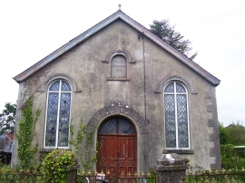
Llanfallteg - Rhos Chapel
Llanfallteg - Rhos Chapel plaque
Llanfallteg - Rhos Chapel
Location and coordinates are for the approximate centre of Parc-chwarel Wood within this administrative area. Geographic features and populated places may cross administrative borders.