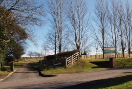
Ollerton Hills, Nottinghamshire

« Gazetteer Entry
Upload Photo

Ollerton Hills, Nottinghamshire

  • Parish/Community: Rufford
  • District/Borough: Newark and Sherwood
  • County: Nottinghamshire
  • Region: East Midlands
  • Category: Landcover
  • Type: Forest or Wood
  • Latitude/Longitude: 53°11'13"N 1°1'41"W
  • Eastings/Northings: 465038, 365998
  • OS Grid: SK650659
  • Mapcode Local: GBR 9GB.BVB
  • Mapcode Global: WHFH0.55N1

Location and coordinates are for the approximate centre of Ollerton Hills within this administrative area. Geographic features and populated places may cross administrative borders.

BritishPlaceNames.uk is a Good Stuff website.