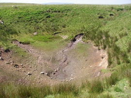
Mynydd-y-glog, Rhondda, Cynon, Taff

« Gazetteer Entry
Upload Photo

Mynydd-y-glog, Rhondda, Cynon, Taff

  • Parish/Community: Hirwaun
  • Unitary Authority: Rhondda, Cynon, Taff
  • Region: Wales
  • Category: Geographic Feature
  • Type: Hill or Mountain
  • Latitude/Longitude: 51°46'29"N 3°29'13"W
  • Eastings/Northings: 297500, 209500
  • OS Grid: SN975095
  • Mapcode Local: GBR YK.Z7PX
  • Mapcode Global: VH5G7.HNXB

Location and coordinates are for the approximate centre of Mynydd-y-glog within this administrative area. Geographic features and populated places may cross administrative borders.

BritishPlaceNames.uk is a Good Stuff website.